Information
Information bulletin
Entry point to informative content and materials published within the current site structure.
Details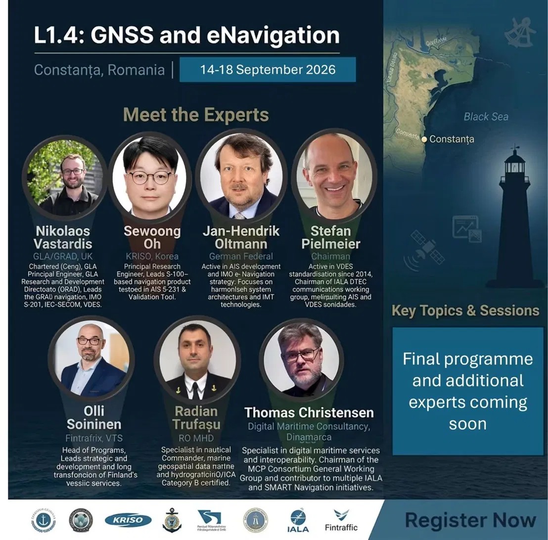
Direcția Hidrografică Maritimă vă invită să participați la seminarul „L1.4 GNSS și e-Navigation”, organizat în colaborare cu Organizația Internațională de Asistență Maritimă pentru Navigație (IALA), în perioada 14-18 septembrie 2026, la Constanța.
Programul de formare abordează subiecte esențiale pentru viitorul navigației maritime, precum e-Navigation, serviciile maritime digitale, standardele S-100/S-200 și reziliența serviciilor de Poziționare, Navigație și Timp (PNT).
Seminarul va fi susținut de experți internaționali din cadrul IALA și al organizațiilor partenere, reprezentând o oportunitate valoroasă pentru profesioniștii din domeniul maritim de a-și dezvolta competențele și de a se familiariza cu cele mai noi tehnologii care sprijină o navigație sigură, eficientă și rezilientă.
The Maritime Hydrographic Directorate invites you to participate in the “L1.4 GNSS and e-Navigation” seminar, organized in collaboration with the International Organization for Marine Aids to Navigation (IALA), from14 to 18 September 2026 in Constanța, Romania.
The training programme addresses key topics shaping the future of maritime navigation, including e-Navigation, digital maritime services, S-100/S-200 standards, and PNT resilience.
The seminar will be delivered by international experts from IALA and partner organizations, providing a valuable opportunity for maritime professionals to strengthen their understanding of digital maritime services and emerging technologies supporting safe, efficient and resilient navigation.
Institutional message
The Maritime Hydrographic Directorate supports, through specialist expertise and documentary resources, activities specific to the maritime domain and access to information relevant to users, partners, and the interested public.
Essential navigation
Charts, nautical publications, certifications and specialist technical services.
Public documents, administrative information, and request templates.
Notices updated daily for Romania's area of competence in the Black Sea.
Updates for the national series of paper maritime navigational charts.
Dynamic content
Information
Entry point to informative content and materials published within the current site structure.
Details