


Topo-geodetic elevation equipment
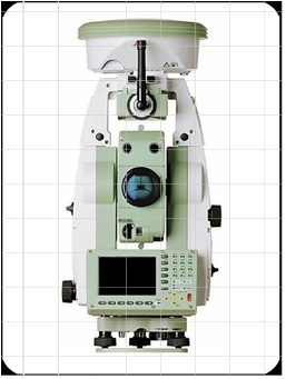
LIDAR SENZOR
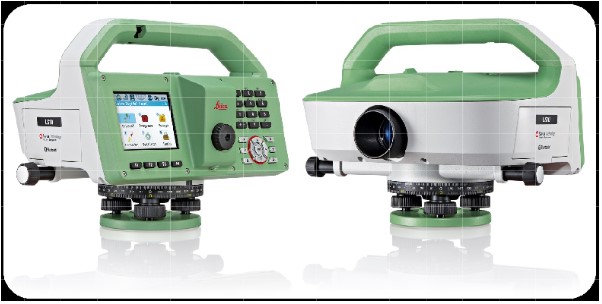
ELECTRONIC LEVEL
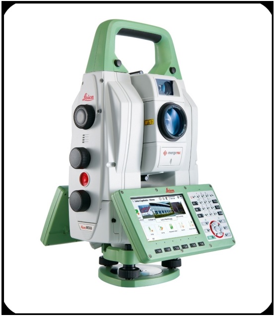
ELECTRONIC TACHOMETER WITH INTEGRATED GPS SYSTEM
It is designated for topographic elevation. The station points fixing can be done with GPS and the measuring of the distances with no prism by means of incorporated laser.
ELECTRONIC TACHOMETER WITH INTEGRATED GPS SYSTEM
It is designated for topographic elevation. The station points fixing can be done with GPS and the measuring of the distances with no prism by means of incorporated laser.
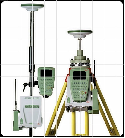
DGPS GEODETIC SYSTEM
Geodetic DGPS (Global Positioning Differential System) with 5 (five) GPS L1 / L2 mobile receivers and 1 (one) GPS L1 / L2 reference station. It is intended for topogeodetic elevations, tracing etc.
DGPS GEODETIC SYSTEM
Geodetic DGPS (Global Positioning Differential System) with 5 (five) GPS L1 / L2 mobile receivers and 1 (one) GPS L1 / L2 reference station. It is intended for topogeodetic elevations, tracing etc.
GNSS (GPS) SYSTEM ROVER RTK
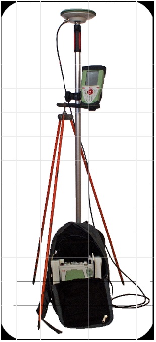
GNSS (GPS) SYSTEM ROVER RTK
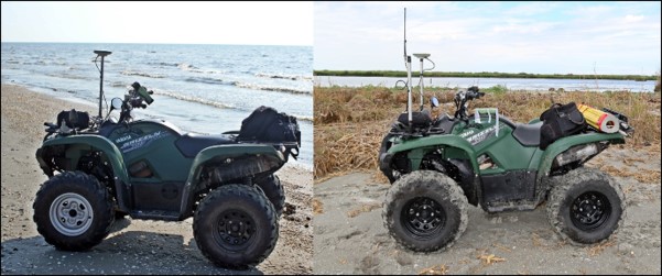
UTILITARY VEHICLE – TOPOGRAPHIC LABORATORY QUADRICYCLE WITH ENGINE AND TRAILER FOR SANDY AND DIFFICULT TERRAIN
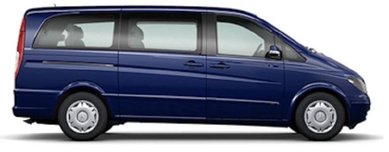
TOPO-GEODESY LABORATORY
Vehicle transport of people, equipment and topo-geodetic materials for the execution of the topo-geodetic research missions and its use as a mobile office for work in isolated areas and long-term missions.
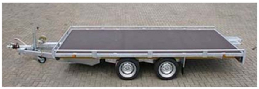
PLATFORM FOR ATV TRANSPORT
Trailer (platform) for the transport of ATVs, necessary to carry out the topo-geodetic research missions.
QUADRICYCLE WITH MOTOR AND TRAILER FOR SANDY AND DIFFICULT TERRAIN
Vehicle transporting people, equipment and topo-geodetic materials for the execution of topo-geodetic research missions in hard-to-reach areas.
TOPO-GEODESY LABORATORY
Vehicle transport of people, equipment and topo-geodetic materials for the execution of the topo-geodetic research missions and its use as a mobile office for work in isolated areas and long-term missions.
PLATFORM FOR ATV TRANSPORT
Trailer (platform) for the transport of ATVs, necessary to carry out the topo-geodetic research missions.
QUADRICYCLE WITH MOTOR AND TRAILER FOR SANDY AND DIFFICULT TERRAIN
Vehicle transporting people, equipment and topo-geodetic materials for the execution of topo-geodetic research missions in hard-to-reach areas.